For contractors · landscapers · investors · agents
Boundaries, zoning, owner, assessed value, flood risk, AI answers, and a full satellite site analysis. In the field, on your phone.

What it does
County GIS, FEMA, the tax assessor, and a site visit — unified into a single tap on a map.
Tap any address for the parcel boundary, owner, zoning, land use, acreage, and assessed value.
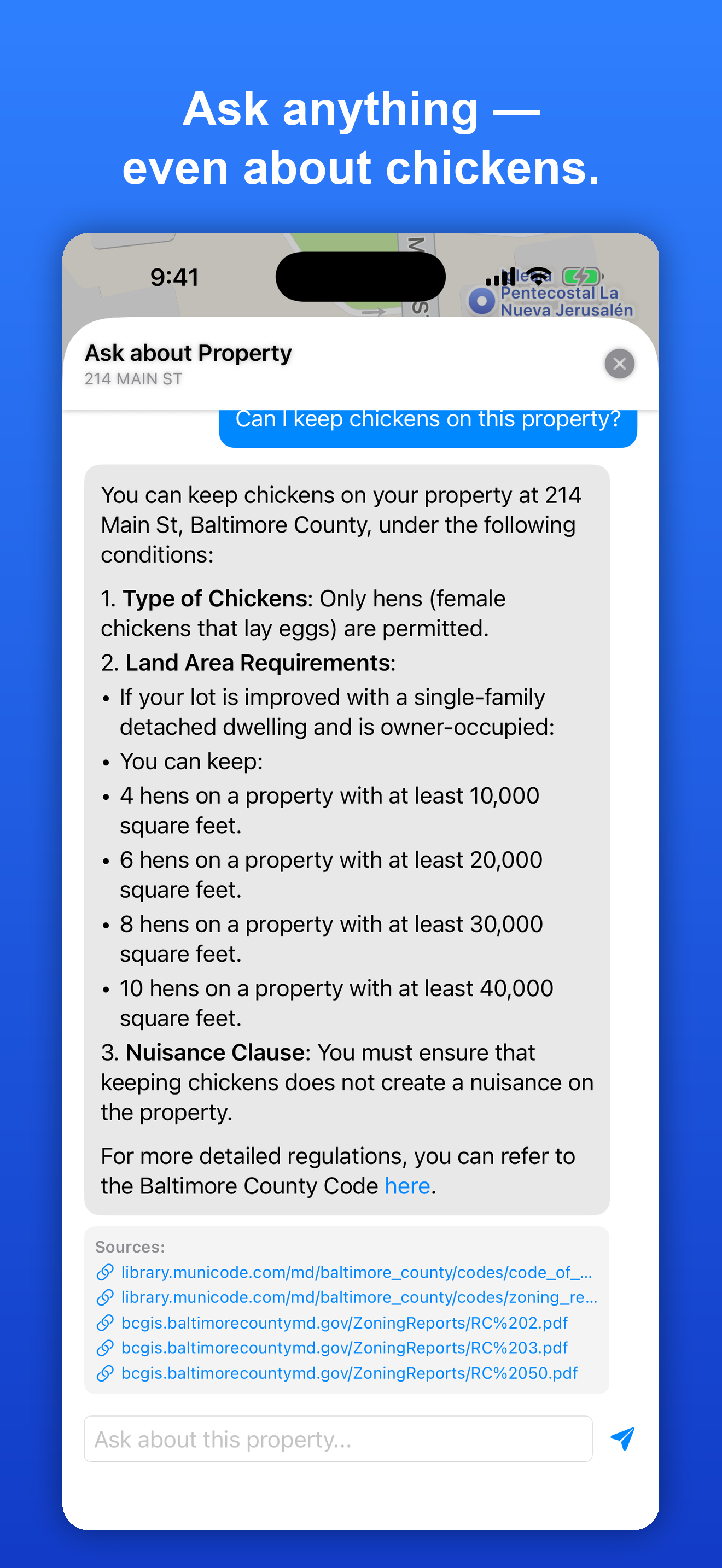
“What are the setbacks?” “Can I keep chickens?” Plain-English answers grounded in the local ordinances.
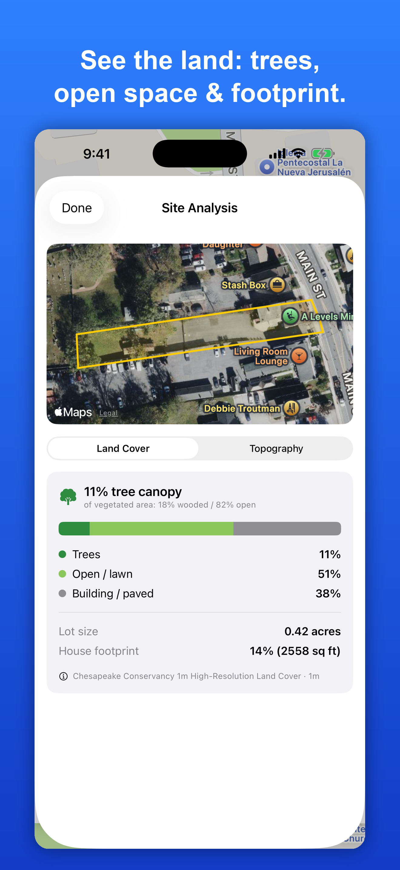
Tree canopy vs. open vs. paved, house-footprint coverage, and lot size — straight from the imagery.
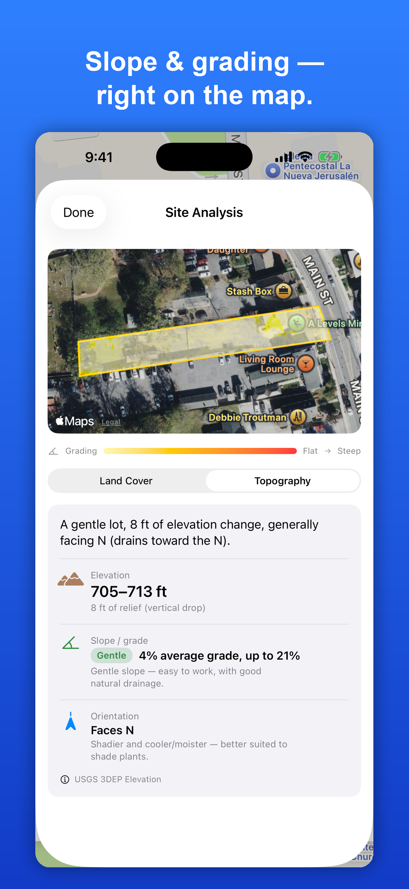
Elevation, grade, drainage direction, and a color grading overlay right on the satellite map.
FEMA flood zone and neighborhood demographics, alongside the parcel — in one place.
Walk the lot lines with GPS to visualize boundaries on the ground while you're on site.
How it works
Search or tap the map and OrdinanceIQ snaps to the parcel — boundary, owner, zoning, land use, acreage, and the assessed value from county records.
Type a question in plain English. The assistant reads the actual local code and answers — zoning, setbacks, permitted uses, even “can I keep chickens here?” — with sources.
A satellite breakdown of the lot: tree canopy, open space, and building/paved area, plus exact lot size and house-footprint coverage.
Elevation, slope, and which way the land drains — with a color grading overlay painted onto the satellite map so you can spot the steep areas at a glance.
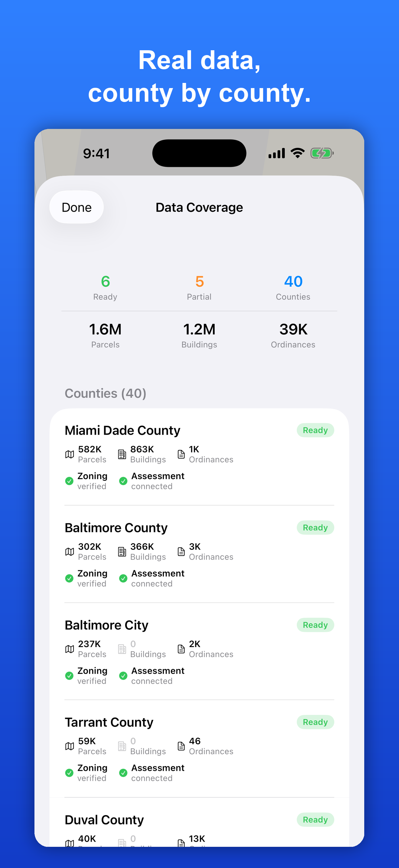
Check the in-app Data Coverage page to see exactly what's available in each county — parcels, zoning, ordinances, and assessments — and request your area.
Built on real data
Parcels, zoning, assessments, flood, land cover, and elevation from county/state GIS, FEMA, USGS, and the Census.
*Where high-resolution data is available; national fallback elsewhere. Estimates, not a survey.
Contact
Send us a message — it reaches the team directly.